Statement from the National Emergency Coordination Group on Severe Weather
2 October 2019
A National Emergency Coordination Group meeting was held today (Wednesday 02 October), chaired by Minister Eoghan Murphy. Minister Kevin Boxer Moran was in attendance also.
Met Éireann’s current forecasts indicate that Storm Lorenzo will move across the country during Thursday night into Friday morning, moving NorthWest to SouthEast across the country, potentially bringing strong winds, rain and the threat of coastal flooding. Met Éireann have issued weather warnings and advisories and these are available on www.met.ie (link is external).
Report of the National Emergency Coordination Group meeting
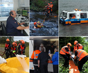
The National Emergency Coordination Group met today in anticipation of the arrival of Strom Lorenzo. The Department of Housing, Planning and Local Government is designated as the Lead Government Department for coordinating the response to severe weather emergencies at national level.
Local Authorities, who are the lead agency for the response to severe weather have activated their Crisis Management Teams and Local Coordination Groups in preparation for the arrival of Storm Lorenzo. Preventative actions taken to date include clearing drains and gullies and preparation of sandbags.
Relevant Departments and Agencies remain in a state of preparedness in expectation of the arrival of Storm Lorenzo.
Key Public Safety & Information Messages
- More detailed Public Safety Messaging will continue to be issued throughout Wednesday and Thursday.
- People are advised to monitor news and other local sources of information.
- In areas affected it is likely there will be:
- High seas; the public are advised to stay away from coastal areas during this period. The Irish Coast Guard are appealing to people to “Stay Back, Stay High, Stay Dry”
- Very strong winds are predicted which will make driving conditions hazardous, especially for the more vulnerable road users, e.g., cyclists, pedestrians, motorcyclists and high sided vehicles. Road users should pay particular attention to the risk posed by fallen trees and flying debris as trees are in full leaf.
- There is a potential for tidal flooding in coastal areas. In addition to this, the storm may also bring localised heavy showers, which in turn may lead to spot flooding.
- Employers should plan today in conjunction with their employees to make arrangements taking account of anticipated travel conditions on Thursday evening into Friday. We advise people make arrangements taking any warnings into account when planning their journeys to or from work.
- People are urged to check on isolated or vulnerable neighbours and family members.
- People should be extra vigilant and aware of the risk potentially posed by trees in high wind events. The most widespread and potentially dangerous consequence of high wind is the risk of trees breaking/falling, possibly bringing down live power lines, posing a danger to motorists and pedestrians in the vicinity.
- People are advised to prepare for the arrival of the storm including ensuring their mobile phone is fully charged to enable communication.
The public are again reminded to monitor Met Éireann forecasts for their area and to be aware of the weather conditions and to heed safety warnings. Information is available across social media platforms and other traditional media sources.
The National Emergency Coordination Group is continuing to monitor and prepare for the storm and will meet again tomorrow, 03 October at 10.30am to review the developing situation.
Acmhainní do Theagascóirí
-
14 July 2026
-
29 June 2026
-
19 June 2026
-
19 June 2026